Yes, you read that headline correctly, big changes are, in fact, coming to the famous Bear River Migratory Bird Refuge auto tour route, a self-guided 12-mile gravel road that winds through thousands of acres of wetland and upland habitat managed for migratory and resident birds by the U.S. Fish and Wildlife Service.
The changes are only temporary, however, but during the spring and summer months on the refuge, all visitors wanting to take a drive and enjoy some birdwatching or photography will have to adapt to a new alternative auto route for several months while the long-time established loop is closed for a spell.
(Advertisement)
After hearing about this closure a couple of weeks ago, I reached out to Carl Millegan, the current Bear River Migratory Bird Refuge manager, for more information and to request a drive on the upcoming temporary route to take some photographs (image gallery below) and video (embedded below) in hopes of showing visitors what can be expected on this new drive as well as to try and answer some of questions you may have about the changes from my perspective after driving the route.
He graciously accepted to take me on the new route for a photo shoot and answer any and all questions I had regarding the change, as well as giving me a heads up on lots of other work the refuge is doing to enhance the habitat and the visitors’ experience on the refuge.
To start off with the auto tour route change starts on April 4, 2026 and will run through mid-September, during this time the auto loop as we have known and loved for decades, i.e. unit 2, will be closed to all public access for construction and the temporary route will be open in its place 7 days per week, sunrise to sunset, with some portable restrooms placed along the way.
Sometime before the closure, however, water will be diverted from unit 2, the established auto loop, and sent to other areas of the refuge so the ground can dry out for the heavy construction equipment required to do the work can get around the specific work sites as needed.
Once the construction work is finished, water will then be diverted back into unit 2, and the auto loop will be open and functioning as usual, and the temporary route will be closed once again.
(Advertisement)
(As an Amazon Associate, I earn from qualifying purchases.)
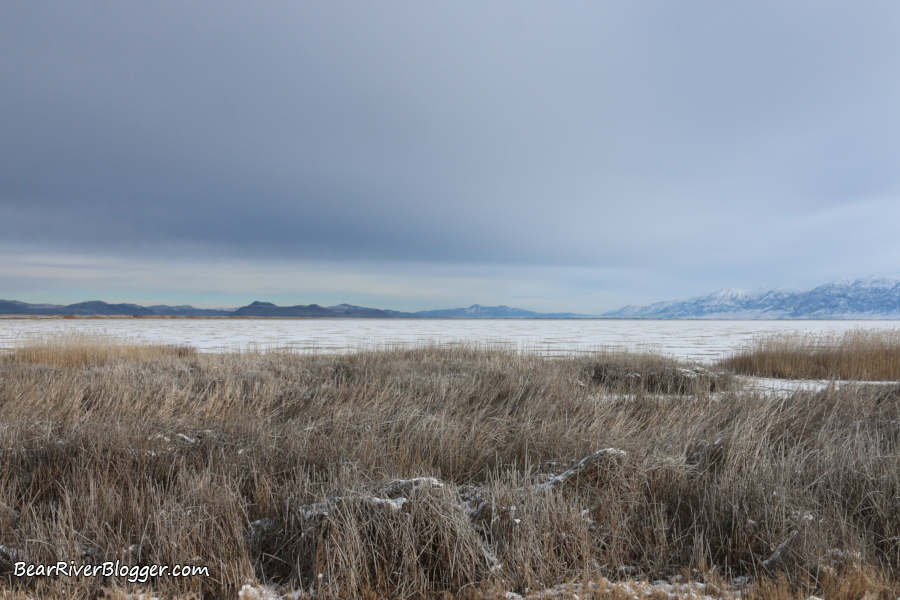
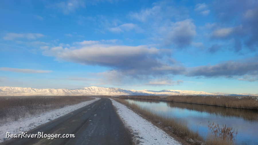
On today’s drive, I noticed some of the units along the new auto route are currently dry, but Carl mentioned the refuge will be diverting water into these units for spring and summer, which should attract birds into those areas.
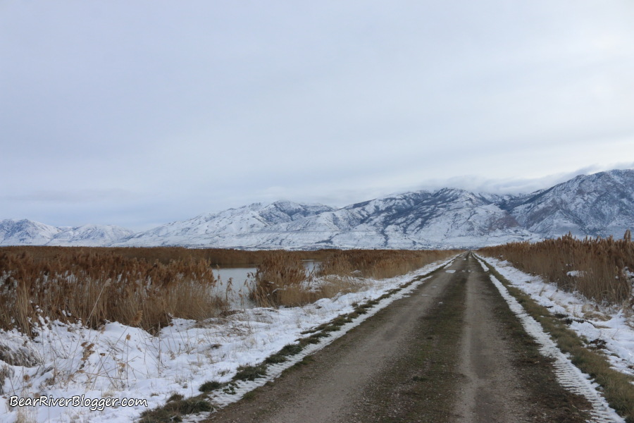
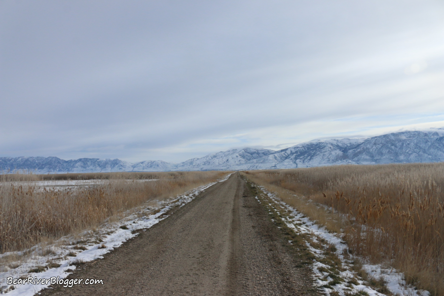
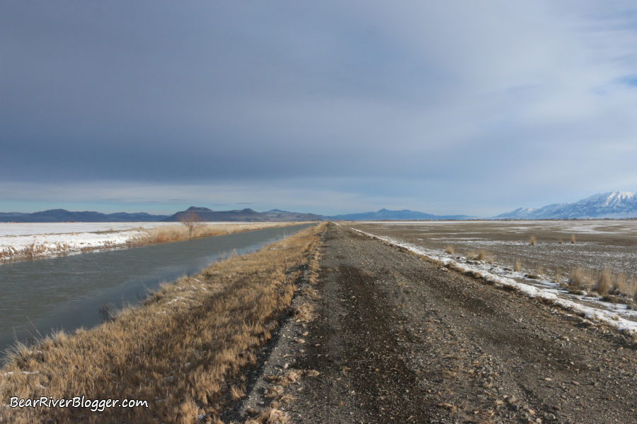
Just like the main route, the temporary drive will also be one-way, starting along Forest Street by the third canal that crosses the road (see attached map) and ending just west of Interstate 15 in Perry.
(Red-closed auto tour route, Blue-forest street, Purple-temporary auto route)
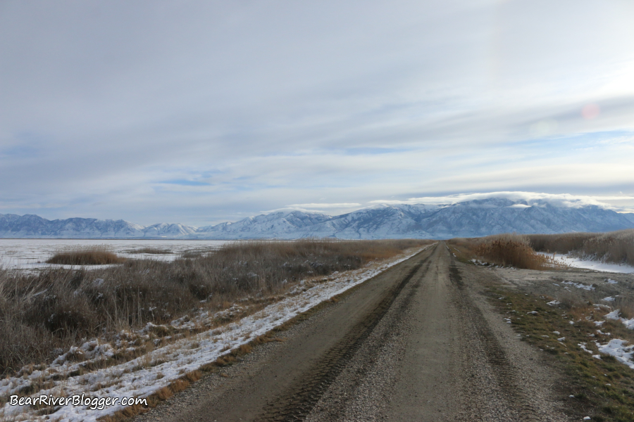
By looking at the map, you will notice, unlike the traditional auto route, the new route isn’t a loop but an “L” shaped drive that primarily heads east until you reach the exit point after an approximate 12-mile drive, similar in length to the old route.
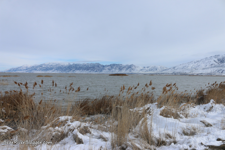
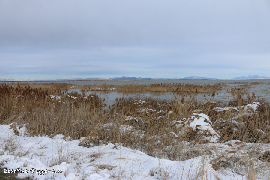
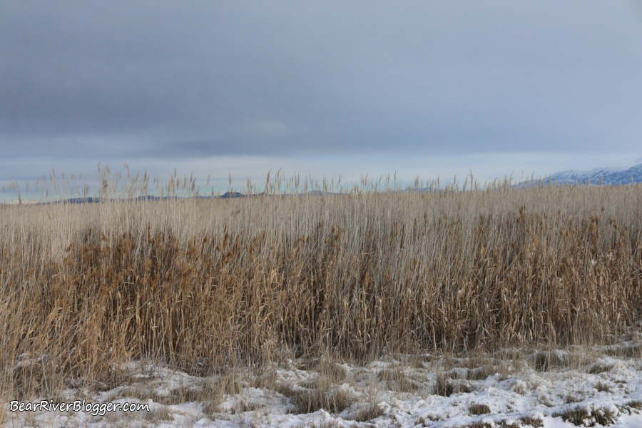
Initially, the first section of the drive will be kind of empty, mostly mud flats and a canal that parallels the road, but once you reach the corner and head east, the drive gets a lot more interesting when you start to make your way through the actual wetland habitats.
There are places, as you drive eastward, that are more open and visible, and there are other spots that are kind of blocked with walls of phragmites, similar to the established auto tour route in various locations.
All in all, the new temporary auto route seems to be fairly similar with regard to wetlands when compared to the traditional route, so it is fair to assume the same waterbirds should be visible on the new drive.
One more thing to note, however, is there are no parking lots or pull-offs on the new route and there isn’t much, if any, upland or grassy habitat areas nearby, except what’s along the gravel road, so specific birds commonly found along those upland areas on the old loop might be a bit harder to locate with a mostly marsh-like habitat in close proximity of the drive.
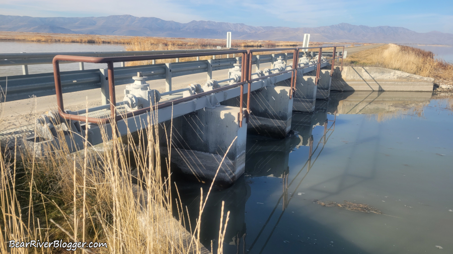
The reason all of this construction and changes to the auto loop are taking place relates to the concrete bridges and water control structures visitors drive over on the auto tour route, some of them are being torn out this summer and replaced, rendering the loop impassible with huge holes left in the roadway when that happens until the new concrete structures are built and the auto route is, once again, ready for traffic.
The old structures utilize heavy boards that hold back the water, making pulling and adding these wooden planks quite dangerous as it has to be done manually, sometimes utilizing two employees and maybe even a backhoe when the boards are frozen in place, or there is too much water pressure to easily allow removal or replacement by hand.
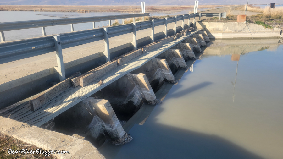
I have actually been told in previous conversations with refuge staff that sometimes those tasked with pulling the boards fall into the water and get pulled through the raceway, so replacing them with a fully mechanical set of headgates will not only allow for more precise water control, but it is also much safer and more efficient for refuge staff to change the water levels.
Once the work is done, gauges will be placed on all of the outlets so water flow from the refuge to the Great Salt Lake can be measured and compared to flows on the Bear River itself, which will allow a determination of how much water the refuge actually consumes from evaporation and seepage into the ground.
I will admit it’s a huge change not to have the traditional auto tour route during spring and summer for birdwatching and photography, as I have been driving it since the early 1990’s after it was rebuilt from the spring floods of 1984, resulting in many distinct locations along the loop where I always look for and expect specific birds and unique scenery to photograph.
But instead of just shutting down the auto tour route completely and not offering some kind of alternative route, the refuge staff decided to offer this new drive as an option for birdwatchers and photographers, like myself, to come and enjoy the Bear River Migratory Bird Refuge during spring migration and the summer breeding season.
After taking a tour of the alternate drive and seeing it firsthand, I plan on trying the temporary auto tour route this spring and summer, giving it the benefit of the doubt and hoping it can be just as rewarding as the traditional route, and I hope to see you out there as well.
If you are a birdwatcher or nature photographer, I suggest visiting our subscribe page and signing up for email notifications for future blog posts about our passion for photographing nature, both on and off the famous Bear River Migratory Bird Refuge auto tour route.
Photo and Video Gallery of the Temporary Auto Tour Route
(Changes To The Bear River Bird Refuge Auto Tour Route. For short nature photography tips and interesting stories about the natural world around us, subscribe to our Bear River Blogger channel on YouTube for videos and updates from our travels while out in nature, both on and off of the famed Bear River Migratory Bird Refuge.)